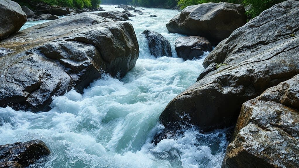
River rapids form when water encounters steep gradients, narrow channels, and uneven riverbeds, which together enhance velocity and create turbulence. Sharp drops and constricted passages force the flow to accelerate, while hard rock outcrops and boulders disrupt the surface, forming whitewater, eddies, and standing waves. Seasonal snowmelt or low‑flow periods can amplify these effects, and events like floods, landslides, or debris fans add sudden surges that sharpen the churning currents. Keep exploring to learn how each factor shapes the rapids in detail.
TLDR
- Rapids develop where steep gradients accelerate water flow, increasing kinetic energy and turbulence.
- Constrictions in the channel force the same discharge through a smaller area, boosting velocity and creating frothy whitewater.
- Hard, resistant rock outcrops or boulders act as obstacles that split and lift water, forming eddies, standing waves, and boil lines.
- Differential erosion creates uneven riverbeds with alternating hard and soft rocks, producing ledges and steps that intensify turbulence.
- Seasonal events such as snowmelt floods, low‑flow dry periods, and landslide debris alter water volume and channel shape, enhancing rapid formation.
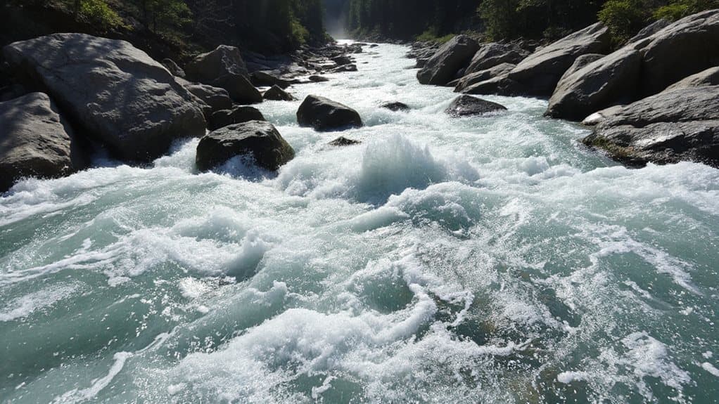
What Are River Rapids?
When a river drops sharply over a short distance, the water speeds up, churns, and throws up bubbles, creating what we call rapids.
You’ll see shallow, rock‑strewn sections where water rushes, splashing and aerating, forming whitewater that enhances downstream oxygen.
Flow, gradient, constriction, and obstacles combine to create these turbulent, free‑spirit passages that thrill adventurous paddlers. Harder rocks persist and shape the uneven streambed, intensifying the rapid’s turbulence. The Colorado River is an example of a waterway that offers a wide variety of rapid types across long distances.
How River Gradient Creates Fast‑Flowing Water
River gradient—essentially the slope of a river’s channel—drives the speed of the water flowing over it. When the channel steepens, gravity pulls harder, accelerating the flow, enhancing kinetic energy, and stirring turbulence.
Narrow sections amplify this effect, squeezing water into a tighter space, creating rapid, frothy currents. In headwaters, sharp drops concentrate power, while gentle slopes downstream calm the surface.
How Differential Erosion Shapes River Rapids
Because rivers encounter alternating bands of hard and soft rock, the softer material erodes more quickly, leaving a jagged, uneven riverbed that forces the water to tumble over sudden drops and protruding ledges.
You’ll see hard granite or dolomite outcrops persisting as ledges while shale and sandstone wear down, creating steps and turbulence.
Hydraulic action, abrasion, and corrosion deepen these contrasts, producing churning, white‑water rapids that reflect the underlying differential erosion.
In challenging conditions, environmental factors like strong currents can significantly amplify turbulence and alter how rapids form.
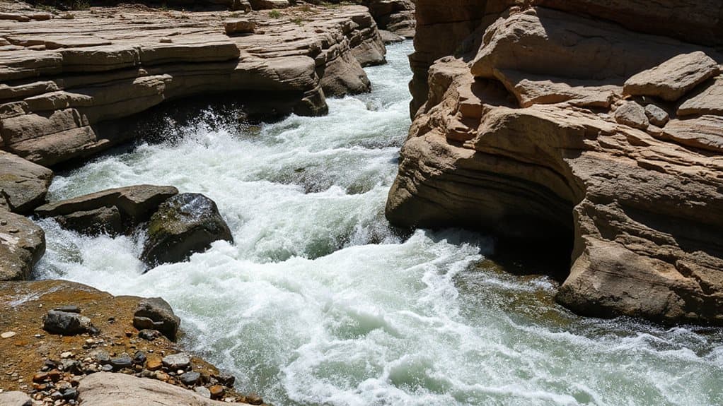
How Channel Constriction Forms River Rapids
Hard‑rock ledges and soft‑rock erode at different rates, but the next step in rapid formation often comes when the river is forced into a tighter space.
When the channel narrows, the same discharge squeezes through less area, so velocity spikes, turbulence roars, and whitewater energy concentrates.
You’ll see deeper cuts, sharper chutes, and chaotic surface textures, all amplified by the confined, faster flow.
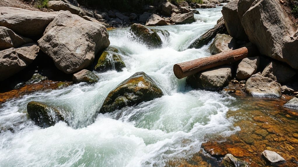
How Large Obstacles Produce River Rapids
When a boulder or ledge forces the water to split and rise, you’ll see the flow divide around the obstruction, creating strong turbulence and eddies.
The resulting turbulence, especially around large, partially submerged rocks, generates boil lines and standing waves that churn the surface.
As the water re‑converges downstream, energy dissipates over the submerged ledge, shaping the rapid’s intensity and character.
Beginners should start with Grade 1 and 2 to learn how to read currents and handle these features safely.
Rock Deflection and Flow Division
If a boulder or fallen tree sticks out into the active flow, the water can’t just push straight through; it’s forced to split and slide around the obstruction, creating two faster side‑channels and a low‑pressure zone downstream.
You’ll see the current accelerate laterally, then merge, forming surface boils and uneven velocity patterns; larger protrusions intensify these effects, especially in narrow passages where discharge is high.
Turbulence Generation Around Boulders
The water that splits around a boulder or fallen tree soon meets the obstacle’s upstream face, where the flow separates and creates a wake that rolls downstream.
You’ll see a recirculation zone extending roughly 1.4 boulder diameters, packed with horizontal and vertical vortices that elevate turbulent kinetic energy two‑to‑threefold.
These wakes intensify shear stress, shred laminar flow, and forge the choppy, rapid‑like surface you crave.
Energy Dissipation Over Submerged Ledges
Because a submerged ledge forces the water to drop abruptly, the flow instantly accelerates, then decelerates as it passes over the crest, generating intense turbulence and rapid energy loss. You’ll feel the kinetic surge turn into chaotic eddies, air‑filled rollers, and shear layers that dissipate power.
Rough slopes, steep faces, and deep tailwater amplify the hydraulic jump, spreading turbulence downstream, protecting banks, and shaping the rapids you crave.
Seasonal Flow Changes That Intensify River Rapids
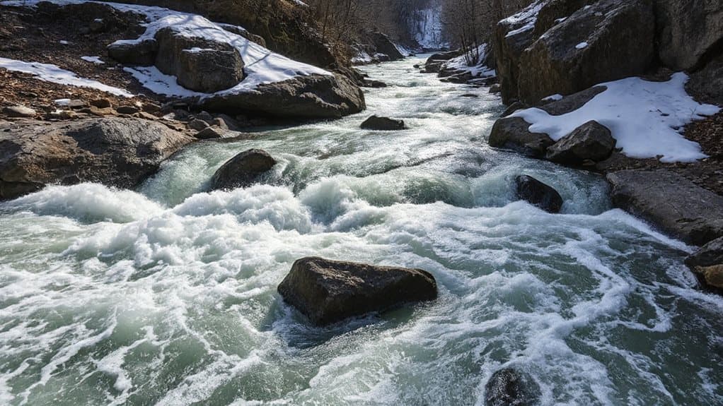
You’ll notice that spring snowmelt surge floods the channel with massive water volumes, turning modest obstacles into roaring rapids, while in the dry season low‑flow concentration squeezes the same water through tighter passages, sharpening turbulence and creating tighter, more technical waves.
Both extremes augment hydraulic force, but the mechanisms differ: the melt adds sheer volume, whereas drought concentrates flow.
Understanding these seasonal shifts helps you anticipate rapid intensity throughout the year.
Filters like the Sawyer Squeeze are useful for backpacking trips to these rivers when you need reliable water treatment.
Spring Snowmelt Surge
During spring, warming temperatures and longer daylight melt the winter snowpack, turning the high‑elevation reservoir of frozen water into a steady surge of meltwater that pours into streams and rivers.
This surge enhances discharge, so water rushes faster through narrow chutes, over boulders, and across uneven bedrock, creating standing waves and turbulent hydraulics.
You’ll feel the river’s power rise quickly, especially after rain‑on‑snow events, demanding heightened awareness and safety preparations.
Dry‑Season Low‑Flow Concentration
When dry‑season low‑flow conditions set in, water concentrates into a narrower channel, and that concentration can actually sharpen a river’s rapids.
You’ll notice tighter currents, steeper drops, and more defined eddies, especially where dams release steady 700‑2,000 CFS.
Those focused flows turn big, roaring rapids into technical, family‑friendly runs, letting you paddle with confidence while the river still feels wild.
Event‑Driven River Rapids: Landslides, Floods, Debris Fans
Landslides, floods, and debris fans are the three main drivers that turn a calm river into a series of rapid, chaotic stretches.
When a steep slope collapses, water‑saturated debris surges downstream, thickening flow and enhancing force.
Floods erode banks, deliver sediment pulses, and can breach landslide dams, releasing sudden surges.
Debris fans at tributary mouths redirect water, narrow channels, and create turbulent, fast‑moving currents that feel like pure, unrestrained exploration.
How to Identify River Rapids on a Map
Landslides and floods may create the raw power that forms rapids, but spotting those turbulent stretches on a map starts with reading the terrain’s clues.
Look for V‑shaped contour lines pointing upstream, tight contour spacing, and narrow valleys that pinch flow.
Check symbols for rapid icons, class numbers, and nearby bridges or campsites.
Cross‑reference digital guides, USGS gauges, and YouTube footage to confirm current conditions.
And Finally
By understanding the gradient, erosion, channel shape, obstacles, and seasonal or event‑driven changes, you can recognize why rapids form and how they behave. Spotting these features on a map lets you predict where fast‑flowing water will appear, helping you plan safe routes, enjoy white‑water activities, or study river dynamic with confidence.


